Friday, February 25, 2011

Approaches to Jerusalem


Here is another paper. This is from our Jerusalem Approaches Trip. That is pretty much a broad name for all the things we did. It was a great trip. We saw some pretty incredible sites; Mt. of Olives and Bethlehem to name two. I hope you enjoy the paper. As usual Pictures are included!


This week we were able to travel to the areas around Jerusalem. The first place that we stopped was on the eastern side of the Mount of Olives. Right in front of our view was a wall to separate the West bank. However, on the other side of the wall of the left, there was another mountain which is present day El Azariah. In Biblical times it was known as Bethany, the hometown of Lazarus and just 2 miles from Jerusalem. There are tombs from the 1st century AD, showing that there was a settlement during the time of Christ.  Just west of Bethany (where we were standing) is the area of  Bethphage.
  While we were on the mountain top, we turned to map 11-7 in our map book, discussing the last days of the ministry of Christ. In John 11, He raises Lazarus from the dead in order to show the glory of God. He demonstrates that He is the light of the world. At the the end of the day, the question is whether we believe that He is the resurrection and the life. Lazarus was in the tomb for 4 days, he came out with the linens still wrapped around his body. Christ had the power to keep Lazarus from dying, but decided that the best way of demonstrating His power would be to raise him from the dead.
            Bethphage is mentioned in Matthew 21, as the Triumphal Entry of Christ.  At this time Jesus still had the support of the people at the time of the feast, which was probably the Passover. This would have been the general area where they found the donkey, in order to  fulfill the prophecy. He rode the donkey down the Mount of Olives into the temple, this would be Sunday of  the Passion Week. On Monday, He goes back to the temple and cleanses it from the idolatry. On Tuesday, He is swarmed with an angry mob: questioning His authority. At this time we looked at Matthew chapter 24-25, dealing with the Olive discourse, talking about the signs that would appear at the end of the age. On Thursday, the upper room was prepared, the last supper took place and Jesus experienced six different trials. Friday at 9 am is when Christ was crucified and Sunday was when He was resurrected. During the whole account Christ was based in Bethany during the passion week.
            The Ascension mentioned in Luke 24:50 was on the eastern side of the mount of Olives, it says that He led them toward Bethany, and then lifted up His hands, a cloud covered Him as He ascended into Heaven. We do not know the specific time that He will return, but we know that He will return in the same manner.
            We continued to the Paternoster Church, a traditional spot, on the mount of Olives. At this church the Lord's prayer is in about 100 different languages. This example of prayer speaks about the Lord's will and about our daily needs. The Lord does not want us to pray with empty phrases. Prayer is suppose to be a reminder that we need to be dependent on Him. Through the word choice of 'Our Father' there is a demonstration of a relationship, He is our Father and truly wants what is best for us.
            As we walked down the mount of Olives, we stopped right above the cemetery. Some of the tombs are 5,000 years old!! From this view there was a good view of the Old city. To the right, we could see the 'tear drop' where Jesus wept over the city of Jerusalem and the “Mary Magdalene” Russian church. As we continued down the mountain, we stopped at Dominus Favi (the tear drop). In Luke 19: 41-44, is where it mentions that Christ wept over the city of Jerusalem. In Matthew 24, it says that no one knows the day or the hour. There could be a time gap and part of the chapter could be discussing the 2nd coming. It was clear though that He was giving warning about false prophets, a sign does not mean that they are of Christ. We have to continuously be on the watch and ready for the return of the Lord.
            Garden of Gethsemane, this is the traditional place from the Byzantine period. It means oil press. He brought Peter, James, and John, it was a place known to the disciples and the account is in John 18:1. The 
Church of the Nations is built on this site. Just outside of Gethsemane was a cave, where tradition says that this is where the disciples slept. The cave was used to make oil form the olive press. There is a possibility that from the 2nd Century AD, there is a connection to the garden in some sort of way. In Mark 14, it discusses how there was a man that had a linen cloth around his naked body, and followed Christ after he was arrested. This could possibly show that they were planning on staying the night there. Also on this site is a church, which is suppose to hold the tomb of Mary.
            Before we arrived in Bethlehem, we stopped at the 'shoulder of the Hinnon valley' Ketef Hinnon. There are tombs, that encircle the city of Jerusalem, like a belt. However, at this spot Edward Robinson discovered tombs from the Old Testament period, from 8th BC. In most cases tombs are robed, but in 1979 there was a discovery because the roof had collapsed blocking the entrance. Inside this old tomb, they discovered silver amulets, which took 2 years to unroll. They were 2in x ? in. It was an interesting find because LORD was the first word in the inscription of a priestly prayer from Numbers 6. It dates back to the late 7th century 610 BC, a good 400 years older than the dead sea scrolls! They are able to use pottery that was discovered and the shape of the letters to see what time period they are from.
            In Judges 17-18, we are able to see a connection to Bethlehem. This passage is used to show how depraved the nation had become set up narrative for David, who is from Bethlehem. In Micah 5:1, the prophecy decrees that the Messiah will be born in Bethlehem. God has the ability to use circumstances for His good. In Bethlehem there is the church of the Nativity, built by Helena,  Constantine's mother. Tradition says that it was built over caves, there also seems to be evidence of a 1st century settlement. As we left Bethlehem, we were able to see some fields, that could have possibly been where the angels appeared to the shepherds. 
            Final stop was Herodian, a palace built by Herod the Great, in the middle of the Judean Desert, as a winter get away. This is  where Herod was buried and just two years ago a sarcophagus was found. He built walls and then packed dirt, had the walls connect to 4 towers, and then there are two walls, where there would be a passage way for servants. The palace was divided in 2 sections on the east there was a covered walkway with vegetation and on the west there were dwelling place and a bathhouse. Herod the Great was considered a half-Jew, so when the Magi came in Matthew 2, they were looking for the one that was Born King of the Jews, Herod was Made King of the Jews. His life ended insickness and a painful death. 


That is the West Bank Wall and just beyond it is Bethany

Same as above

I nice looking flower


A few of the Languages that the Lord's prayer were written in


Christina and friends in front of the hebrew one


Old City and Temple Mount from the MT. Of Olives

Random Camel= pretty sweet


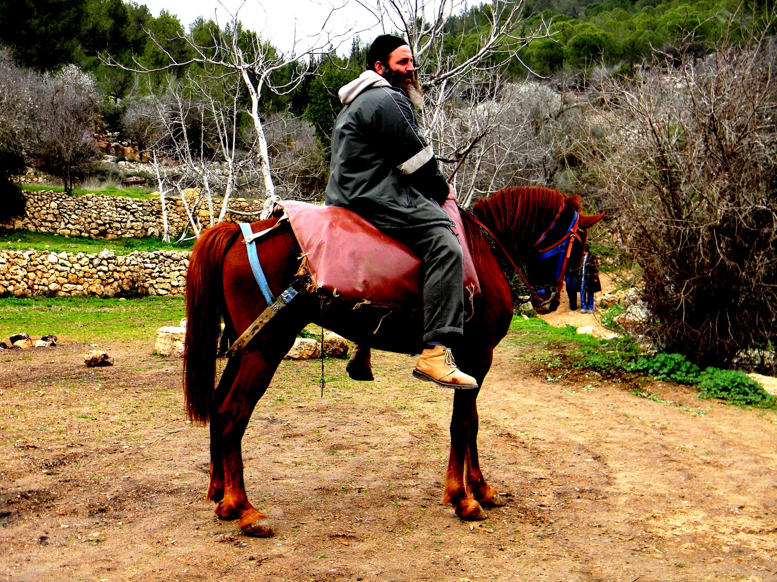
Random guy and Camel= much sweeter

Closest thing we have seen to in and out

In front of the church at the Garden of Gethsemenee

Garden of Gethsemenee


Same Church in the garden

Place where the silver scrolls were found that date to 610 B.C.

Closest thing to Starbucks we have seen. Even looks like it. In Bethlehem. Jesus and Coffee?


Herod's private mountain he built

Inside the mountain. His Palace

On top of the mountain with a great view of the Judean Wilderness

Part of the building


Ben and Christina From Israel!
          

Sunday, February 20, 2011

Parat Springs Hike

This was a very eye opening hike. It was my favorite so far. The whole time we could look out and see the country of Jordan in the horizon. That was cool. I didn't realize how close we were to Jordan but we were very close. We were also in the west bank. This didn't seem to matter much. There were certain towns we didn't go in but besides that it seems pretty peaceful. There wasn't any point at which i was nervous. This was a great blessing to be on this one, even though i had to get up early. I hope you enjoy! If you have questions or what pictures of different sort, or anything i could do better just let me know and i will do my best! Thanks for reading!


This is a map of where we went. We started at at Geba (upper left) and went through the Suwenit canyon and made our way over the mountain to the Parat Springs.


We started our day with a quick stop at what seems to be a good option for the tomb of Rachel. To someone who knows something about Rachel’s burial place and the region we were in this may seem like an odd statement. Genesis 35:19 tells us that Rachel was buried in Bethlehem. We were not near Bethlehem, but we were on the Central Benjamin Plateau which is north of Bethlehem. The “traditional site” for Rachel’s tomb is in the Bethlehem that we all know and love, but if there is one thing I have learned at IBEX it is not to trust the “traditional site” of an event, and that applies here.  We know that the place of Rachel’s tomb must be in the tribal allotment of Benjamin and not in Judea (which is where the Bethlehem we know is) because in 1 Samuel 10: 2 we read about a meeting that will happen at “Rachel’s tomb in the territory of Benjamin.” There is more mention of a Bethlehem in Benjamin in Ezra and Nehemiah so we know that there is one there. Middle Bronze Age tombs have been found in Benjamin, so the dating of the tombs agrees with the time period Rachel would have died in. We do not know for sure if these are the tombs of Rachel, but it is a very good chance that they are because it would have been on a route that Jacob probably would have taken. He would have gone through this place in order to avoid some fortified and possibly troublesome cities that lie along the main route, and this route is also on the way to a spring, which he would have needed to his animals. The evidence lines up with the facts we know about Rachel’s death and burial, so I feel that it is safe to say that we stopped at Rachel’s Tomb on our way to the beginning of our hike.
            We started our hike in Geba. Geba is a city that sits on one side of the Wadi Suwenit, while Michmash s the city that sits on the other side of this wadi. There was some significant event that involved these two cities at this wadi. The most notable is in 1 Samuel 13-14. This is the event involving Jonathon and the Philistine army. Jonathon was camped with his army at Geba and the Philistines were camped just across the valley at Michmash. They are in eye contact of each other and both armies are waiting and anticipating a battle. Saul is in Gibeah of Saul, which is a few mile behind Geba. Due to height of Gibeah of Saul, Saul would be able to see the Philistines and his army lead by Jonathon. One day Saul sees that the Philistine army is in uproar and moving all about. He doesn’t quite know what is going on so he calls to see who from his army is gone. Turn out that Jonathon had climbed down the steep side of the Wadi with and amour bearer and climbed up to surprise attack the Philistine army. He kills twenty of their men before God send a great earthquake which scares the Philistines back out of the hill country. The bible is very specific in naming these cliffs that Jonathon Climbed down. They are called Bozez and Seneh. We climbed down into the valley and stood at a place in which you could see Geba to your right, Michmash to your left and the rocky slopes that Jonathan climbed through right in front of you. This was amazing to see and a great story to learn about while looking at the place it happened. We even did our own reenactment of the story.
            Just north of the rocky slopes in the Wadi Suwenit is a placed the called “The Pass.” The Pass is a low point in the Wadi in which people could easily walk through and get from one side to the other. The rest of the valley was far too steep to be traveling through, so this natural bridge seems rather divine. The Pass in mentioned a few places in the bible. When Joshua traveled all night from Gilgal (down by Jericho and the Jordan River) to Gibeon (in the hill country just west of Geba) he most likely went through the pass. In would be in line with his route that would connect these two destinations. Most notably in Isaiah 10: 28-32 Isaiah tells us that “at Michmash he stores his baggage; they have crossed over THE PASS; at Geba they lodged for the night.” This is talking about the Assyrians coming down into the heart of Israel, and the town that they passed along the way.
            We began to head down Wadi Suwenit. We didn’t walk in the Wadi itself but walked on the ridge above it. This is how you generally travel in the Hill country because the Wadis are too steep to travel in. On the hill we saw lots of flowers and lots of green grass. This is unusual for the desert but it does happen during this time of the year. Isaiah 40:8 says, “the grass withers, the flower fades, but the word of our God will stand forever.” This is evident as we walked through the grass and the flowers because I know that they will fade but that God’s word will not fade but will “stand forever.” We could also see and were in the Judean Wilderness. This was most likely the wilderness that Jesus was tempted in and also the wilderness that John the Baptist ministered in. This is truly a baron place. We didn’t get to see how dramatic it is because it is spring time and the grass and flowers are out, but we did see that this place is not occupied by many cities and is not a friendly environment to live in. We made our way over the top of the ridge and got away from the Wadi Suwenit and toward the Wadi Parat. As we were walking we saw a few shepherds and even stopped in at their home. They were friendly, but being that we were in the West Bank which is dominated by Arabs, we saw only men. When Bill asked where the women were they told him that they were inside because it wasn’t culturally acceptable for them to be seen by us. I thought that was interesting. After trying to pet there donkey (which wasn’t very friendly) we continued on our way. From this place we could see the city of Anathoth. This was the place that the prophet of Jeremiah was born. We made our way over to a Canaanites Tel which was from the Early Bronze Age (3200-2300). Then we went down to our final destination, Parat Springs. In Jeremiah 31:1-11 the Lord tells Jeremiah to put his loin cloth in the Parat Springs, and when he told Jeremiah to come back to got the loin cloth he found that it was ruined. God told him that the same would happen to the pride of Judah. Also Psalm 1 talks about being a tree firmly planted by steams of water. This was very evident as we saw the trees arching over the springs and being feed by the waters. This spring was in the Wadi Parat and is an active place on Sabbath. The spring is gushing from the hill and creating these pools of water which are fun to swim in. We took at refreshing swim in the pools and then got some ice cream to end the day. We got to explore a bit more. We saw a monastery that was built right in the side of the mountain. Bill gave a devotional about the streams and trees being firmly planted as it talks about in Psalm and Jeremiah. Then, after Jon slipped on a rock and put a nice cut in his toe, we boarded the bus and went home. 


Possibly Rachel Tomb?
Not Rachel though

This video scans from Geba to Michmash. This was the best way to show the whole view. The Pass would be in about the middle of the video in between the two cities. 

This is normal. Just a shepherd taking his sheep out. We usually talk to these guys. We talked to this guy but he wasn't the most friendliest guy.  1 sheep costs about $350. See all those sheep? do the math. 

This would be the cliffs Jonathon most likely climbed through. Bozez on the left and Seneh on the right. 

Not Jonathon but hey...

The men

Another shot of the cliffs

Another shepherd. He was friendly. He liked that we were from America

Above the Wadi Suwenit

I saw this turtle and Bill wanted to put it on his head


This is where the shepherds live.

One of the shepherds sons

This is a video of the Wadi Parat. It is very deep. The rocks were being used for rock climbing


A shot from inside the canyon. The Wadi Parat

Wadi Parat

Boy band picture in the Wadi Parat

The water from the Spring


Ben and Christina


Central Benjamin Plateau: which in Includes Jericho


   On this trip we drove in a bus around the Central Benjamin Plateau. The tribe of Benjamin is sandwiched in between Ephraim to the north and Judea to the South. Jerusalem and Jericho are both in this region. We live just outside the border of it. It is a big region of land and very important to Israel. My favorite part of the day was being at Jericho! It was amazing! There has been a significant amount of archeology done there and it all points to the Bible. Surprising? Didn't think so:) It was really amazing seeing the actual place. Jericho actually reminded me of Palm Springs. The whole Rift Valley surrounding the Jordan River actually reminds me of it because it is really dry heat. A truly great day being in the Land of Israel. We drove this area.  I was really impressed by how small the land is. You could probably drive from the Med. to the Jordan river in a hour or 2. It is not big at all, but we have learned that it really is a major and important little chunk of land; most notably it being the land bridge between Europe/Asia with Africa and Egypt. 


  This field trip was a tour of the Benjamin Plateau. The tribe of Benjamin is located in between Judah to the south and Ephraim to the north. This land holds both Jerusalem and Jericho, two major cities of Israel. We started by going west and then looped back to the east as we made our way over to Jericho.
            We started the day with our first stop at Emmaus Nicopolis. This is the traditional site of the walk to Emmaus story found in Like 24. Before we talked about that we looked out into the fog-covered Aijalon Valley. This is one of the main valleys in the Shephelah because it extends further into the hill country than most other valleys. It is a good access route for anyone entering into the hill country because you can get onto the Kiriat Yearim ridge route through the valley. As far as Emmaus goes, this is probably not the site mentioned in Luke 24. This is a Byzantine tradition, but the problem is that the text says it was 7 miles from Jerusalem. The person who said that must have forgotten bible at home the day they found this site because it is not close to 7 miles from Jerusalem. There are a few other possible places for the site of Emmaus. One of them is Abu Gosh, a city just a mile or so from Yad Hashmona. This fits the 7 mile distance and also it would allow them the time to make it back to Jerusalem the same day it happened, which is also what the text says. Then we got back in the bus and drove through the town of Modiim. This is the hometown of Matthias, the father of Judas Maccabaeus. Matthias started the Maccabean revolt against the Greeks when he killed a Greek Solider and Jewish man. He was killed shortly after but his son Judas Maccabeus continued the revolt until they gain independence in 164 B.C., thus the start of the Hasmonian period.
            The ridge we were traveling on is the Beth-Horon ridge Route. This was a major ridge route in antiquity and still to this day. It is a continuous ridge into the hill country that allows travelers to bypass the steep valley and mountain tops.  Along this route the King’s would fortify the cities so that it would keep Jerusalem safe. This route would take the travelers just north of Jerusalem to the road of the Patriarchs, which goes into Jerusalem.  Also the Philistines used this route on seven separate occasions. My favorite is when they tried to attack King David (and God because God was helping David) and King David pushed them all the way from the Rephaim Valley (South west of Jerusalem) to the Beth Horon Ridge route which brought them back to the Coastal Plain. This was after the Philistines were just defeated By King David days before in the Rephaim Valley.
            Our next stop was Nebi Samuel. This is where some people claim the prophet Samuel was buried, but we know that isn’t true because 1 Samuel 25 tells us he was buried at Ramah. We were their not to see the false tombs of Samuel, but to get a good look at the city Gibeon. This is a major city in that the Beth Horon and the Kiriat Yearim ridges route combine here. Also, 2 Chronicles 1 says that Solomon went up the high place at Gibeon and it was there that he received his wisdom from God. The high place of Gibeon looks like it would be the place that we were standing. As you look out around Gibeon you see no other high places around expect the one we were standing on. So, there was a good chance that we were standing were Solomon received all his wisdom. Then we went to Gibeah of Saul. This was the mountain that Saul built his palace on. The positioning was perfect in that it look out on the country in all directions. It would be the perfect place for a leader’s palace. The name of the tel is Tel el Ful. As we were up there we experienced some crazy wind. I know that Tehachapi is known for their wind, but I am not sure I have ever been in wind that strong.
            Our next stop was The Pass. This is a break in the Suwenit Canyon. This canyon is a deep cutting canyon, but at this point it shallows out a bit. This is called the Pass. It is located in between Geba and Michmash. Here we climbed up on a hill their and got a panorama view of the whole setting. We also read the account in 1 Samuel 13 and 14 about Jonathon going from Geba to Michmash and climbing through a deep valley (Suwenit Canyon). He then came up to Michmash and killed 20 men by himself. That was a very cool experience to see where he probably came up through.  Then we took the Taybe Route down into Jericho. That was an experience in itself. This road is practically a single lane road used by 2-way traffic. The other factor is that we are on a cliff the whole way. It was fun doing that in a bus. We saw shepherds on the mountain sides. This is where the mountains of Israel are. Jericho sits around -1400 in elevation, whereas Jerusalem is around 1600. This is a big drop in elevation so the mountains were huge and beautiful. Jericho is the lowest/oldest city on Earth and we got to see evidence to both of that.
            When we got to the ancient site of Jericho we went first to the spot where the wall collapsed on itself. The retaining walls still stood but the city wall had fallen down from the retaining wall and the bricks were underneath the retaining wall, just like the text says. There has been debate on the dating of the wall but the truth is that the wall dates back to the same time it was destroyed by Joshua as the Biblical account tells us. This was in the Late Bronze Age, more specifically 1406 B.C. Then we went to another part of the ancient city that they discovered. It was a big tower that dates back even further than that wall. If I am not mistaken it is the older known structure. It dates back to the Neolithic time period. After reading the Jericho account in Joshua 6 we went to see the place in which they found pots of grain. This is a huge discovery because we know that it was right after harvest. Grain is a valuable thing to the people of antiquity so chances are they would not just leave a ton of grain behind when they left. That would be like leaving money behind when you moved out of you house. But, if they were rushed out of the town or if there town suddenly collapsed then it seems logical that they would leave all there grain behind. Also the grain was burned and there was a burn layer in the same layer the pots are in. This is more evidence to the biblical account because God told Joshua to devote the city to destruction. The burn layer in and around the pots of grain are key support for the biblical account. The interesting thing about Jericho is that it is only 10 acres big. The modern city is much larger but the ancient city is only 10 acres. Why would 600,000 Israelites be afraid of a city that is 10 acres big? That is an interesting question. My unformulated thoughts are because they are just coming out of 40 years in the desert and are not fighting people. They haven’t been fighting and have heard stories of great big people in the land. They were probably afraid because they didn’t trust the Lord enough and they were not used to fighting. That is my thoughts, which may be easily proven wrong. We quickly stopped by the spring that Elisha struck and made clean in 2 Kings 2:1.
            After that we went to King Herod’s Palace. This is not mentioned in the Bible but it is a Palace of Herod the great. It was quite the place. The whole thing stretches over the Wadi Quilt. In fact I would say that it is larger than the Ancient city of Jericho and was only a few miles from the ancient city.  After that we went back to the Moshav via the Ascent of Adummim, which is the southernmost route from Jericho to Jerusalem.


This is Gibeon. We are standing on the High place of Gibeon

This is how they make the huge stones. They chisle the sides and then put lumber in the gap. then they wet the lumber so that it expands and pushes the rock out

Just a police car

The fortress at Gibeah of Saul


the bus ride down into the rift Valley but the Jordan River. this is the descent out of the Hill Country.
Its is video

Out in front of Jericho

That my friends is where the walls came tumbling down. The brick wall tumbled over that retaining wall there. The wall is the part with the rock in it. 

That is the structure dating back to the neolithic age. It would have been much taller. A lookout for the city

Lydia, Andie, Jen, and Christina at Jericho

Me, Christian, and Joel in the same spot


This is where they found the pottery and the burn layer

That is the pottery with the grain in it. Very helpful and critical discovery

Some of our group marching around Jericho


Thanks for looking! Thanks for the prayers!!!

Ben and Christina


Rephaim Valley Hike

Here is a report from a hike I did about a week ago. This is a really neat hike. Here are pictures and a map of where we went. On the map the part that says Rephaim Valley is the part we hiked. The place that we live is along the Kiriat Yearim Ridge. Thanks to my roommate, Andrew Scott Harasick son of Mr. Harasick,  for making this map because i don't know how to do anything like this.


We started off the day with a worship service at our church in Jerusalem and then we jumped in the bus which took us to the zoo; the zoo being our launch pad for the hike. The Valley of Rephaim has a significant part in access through the hill country of Judea. This valley is called an emek, which means that that valley is a bit wider than normal in the base of the canyon. The Hill Country tends to be steep mountains and sharp cutting valleys, which make it hard to travel in. The main and most popular option has been to travel along the ridges and avoid the valleys, but in some cases, like the Valley of Rephaim, the valleys are wide enough to walk a whole army through. In fact the Philistines did just that when David was king in Jerusalem. We read in 2 Samuel 5:17-25 that the Philistines tried to attack Jerusalem twice through the Valley of Rephaim, and twice God delivered them into King David’s hand. The first time David went straight at them with his army and pushed them back. The second time they tried to attack David God told them to go up around the Philistines and hit them from the back. They did this and they ended up pushing them all the way past Jerusalem and up to the Beth-Horon Ridge Route and out to Gezer. With God’s help King David crushed the Philistines and drove them back into the Coastal Plain.
            The Valley of Rephaim is actually a branch of the Sorek Valley. The spot in which it branches is very steep and not friendly to travelers. It is when the valley passes Bether that it widens and becomes friendly for travelers. Bether is a major city in that it blocks the path must be traveled by people travelers in the Valley of Rephaim. Bether is mentions once in Song of Solomon 2:17 when the author says his beloved is like a “gazelle or stag in the mountains of Bether.” Bether is also the last stand f Bar Kochva. He was the man that led the second Jewish revolt against Roman authorities in 132-135 A.D. The eastern border of the valley is the Hinnom Mountain ridge. If a drop of water fell directly on top of the mountain half of it would fall into the Hinnom Valley and half would fall into the Valley of Rephaim. You can see why this would be a good way to attack Jerusalem. It gets the attackers right up the Hinnom Valley, which is right outside the city walls.
            We set off the Valley of Rephaim and stopped at our first of three springs. It was called Ein Lavan. This is an easily accessible place so many people were up there. The spring was beautiful and the wall built up around it served as a nice seat. There we met a man of a horse and watched Bill try to feed the horse carrots. We also talked to some older Jewish people. They were friendly and curious as to what we were doing in Israel. At the end one lady wanted to make sure that we knew the Sabbath was a special day for them and it was like no other, so she repeated it a couple times. Before we got to this spring we stopped at one of the Olive trees in the valley and listened to Bill give an educational/devotional talk on the Olive tree. He explained how they can cut open the tree and graft in branches and they will grow just like a normal branch would grow. In Romans Paul talks about the same thing, but instead of Talked about olive trees and branches he talked about Gentiles and Christianity. Gentiles are grafted into the faith just like a branch is grafted into an olive tree to grow and produce fruit. This next spring was called Ein Hinyeh. At this spring we meet some shepherds and two of the girls got to ride on the donkey they had with them. We looked around for awhile and climbed on the rocks there. I noticed that there was a lot of pottery surrounding this spring. Springs tend to be surrounded by pieces of pottery because it is where they get water and pots usually break. On our way to the next spring we saw a abandoned excavation. This was probably a Byzantine period discovery which doesn’t mean much in Israel. That is a interesting point because if something like that were found in America it would make front page news on every newspaper, but in Israel it wasn’t worth someone’s time. Then we went to our last spring, Ein Balad. There were some teenagers hanging out at this spring. They were making some tea with the water from the spring. This spring was very clear and looked fresh. We sat down and made a fire, sang some songs, and drank coffee before we headed up to the road to get picked up by our bus.


The Rephaim Valley

The First Spring; Ein Lavan

A Guy on a Horse.

Rephiam Valley